
Tim Barrett: Following the Trail of Captain John Smith on Virginia’s Northern Neck
By: Cynthia Adams | Photos by: Nancy Evelyn
Tim Barrett already shares a credit for a National Geographic map, titled “Treasured Landscapes of the Chesapeake Bay.” He is excited by the idea of identifying what Captain John Smith saw—in that pursuit he is following in the watery wake of the nebulous, mythologized captain.
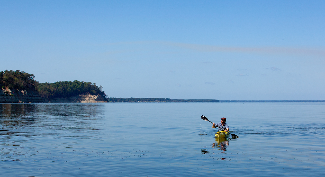
Tim Barrett folds lanky legs into a row boat and takes up a paddle. With a gentle push off the bank, he rows until the forested bank recedes and the small boat is circled with lazy ripples. The warming air vibrates with insects. He swats one away from his lightly freckled face with a red ball cap and grins happily.
Beyond this pond, merely yards away from the millpond, lies the Potomac River, Barrett’s favorite research locus. He likes water. A good thing, too, as he has lived near water most of his life, and now works to advance the recently created Captain John Smith Chesapeake National Historic Trail, the first of its kind.
For the moment, the boat floats lazily. The pond water itself is murky brown, as opaque as strong tea; there are snakes, bugs, frogs, fish, and snapping turtles lurking beneath the small boat. Mysteries lie below. Barrett talks animatedly about the mysteries that are above ground, too. He has a degree in natural resources conservation, and has been an intern with the U.S. National Park Service working as an historical landscape architect. In short, Barrett’s educated eye can see.
For as far as the eye can see, there are greater mysteries to be fathomed for this student in the University of Georgia’s College of Environment and Design’s Cultural Landscape Lab (known as CLL.)
The isolated, wooded spot lies about a mile and a half from what is known as the “Great House” at Stratford Hall near Montross, Va. There are stables and out buildings, slave cabins, a cemetery and even a burial vault which once contained the famously historic bones of Robert E. Lee’s kinfolk. Tools CLL students employ in interpreting these sites will include GIS/GPS technology, remotely sensed images and other sophisticated equipment they use to decipher other sites, including historic Wormsloe at the Isle of Hope in Georgia.
But for Barrett, what concerns him most is the American Indian experience here. And the great Chesapeake Bay, where he has already spent three and a half years in the Maryland offices of The Conservation Fund advancing conservation. (It was here that Barrett got to know founder Patrick Noonan.) Recently Barrett says he “supported a broad suite of activities” to assist Chesapeake Bay conservation leaders in establishing America’s first national water trail, the Captain John Smith Chesapeake National Historic Trail.
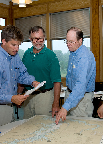
From left to right: Drew McMullen, president of Sultana Projects; John Page Williams, senior naturalist with the Chesapeake Bay Foundation; Pat Noonan, founder and president emeritus of The Conservation Fund. Photo by Michael Schultz.
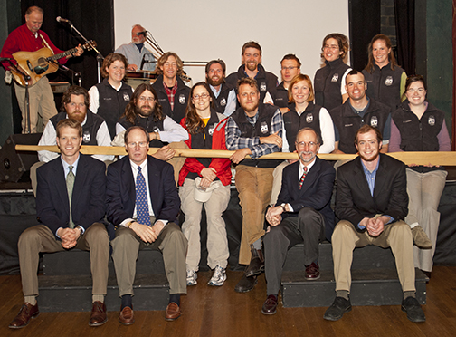
The send-off ceremony for the crew who recreated Smith’s Chesapeake voyages. On the front row, left to right: Joel Dunn, executive director, Chesapeake Conservancy; Pat Noonan; Michael Schultz, and Tim Barrett. “The shallop crew is in the background,” says Barrett. In the summer of 2007, these educators and historians sailed a 28-foot reproduction of Smith’s shallop, spending 121 days exploring the headwaters of nearly all the Chesapeake Bay’s tributaries. Barrett worked as a representative, promoting the John Smith Trail at the shallop’s various stops en route. Photo by Michael Wooten, MCW Photography LLC.
WHERE PRESIDENTS’ BIRTHPLACES ARE “JUST UP THE ROAD”
These historic lands are part of the Northern Neck of Virginia, and the pond whereon he floats is one of Barrett’s favorite spots on the massive lands comprising Stratford Hall. Not many miles away from this, the birthplace of Robert E. Lee, are the birthplaces of Presidents Washington and Monroe. “Stratford Hall,” Lee wrote, “is endeared to me by many memories.” The site depicts Colonial and Federal periods for the many students and scholars who come there to do research.
IT IS A PLACE THICK WITH HISTORY
“Washington’s birthplace is just up the road,” says photojournalist Terry Cosgrove, who has photographed many historic sites close to his Montross, Va. studio. Montross is the nearest town to Stratford Hall. Locals are proudly engaged with Virginia history, he says, especially with Stratford Hall.
“Montross is a town of 320. It’s just an old world, small town,” Cosgrove observes. He sits on the town council and leads their tourism effort. Cosgrove has followed the developments of area historic sites and occasionally writes about them. There is plenty of inspiration in Westmoreland County, where Cosgrove works and lives.
Revolutionary figures lived nearby in such close proximity to one another it is tempting to rename the connecting rural highway threading among them “Revolutionary Road.” Presidents, diplomats, and signers of the Declaration of Independence all came of age in Westmoreland County. Extensive acreage abutting the Potomac on the Northern Neck was once held by the Lees, extending all the way to Little Falls in northern Virginia. This was a watery route well known to Captain John Smith in the early 1600s—one he mapped with amazing accuracy. The lands and waters of the region are of vital interest for historians, conservationists and policy makers.
Closer than even the Potomac to the spot where Barrett idles in a boat is a nearby working gristmill, fully restored some years ago. It is in good working order, and the miller, Steve Bashore, works here and oversees the much larger mill at Washington’s Mount Vernon. Mount Vernon’s mill may be better known, says Bashore, but is no more significant. The Stratford Hall gristmill was a commercial venture in close proximity to the Potomac for ease of commerce. It supported early Colonial homes in addition to Stratford Hall, and until recent years a dock existed, which once served mill patrons.
Nearer still are the “Clifts” as they were once known—whose scaly, claylike banks shed into the Potomac River, causing dangerous slides.
Since May of 2010, Barrett has been working with the College of Environment and Design’s efforts to document and define such features of the Stratford Hall historic and cultural landscape. But Barrett’s thesis work is not necessarily on terra firma. His research concerns the waterways and tributaries explored by Smith that extend many thousands of nautical miles.
What does Captain John Smith have to do with Stratford Hall? For one thing, “He surely saw the {Lee family} property from the water and mapped its shoreline,” says Barrett. Smith is central to Barrett’s research, which concerns “the landscape corridors he mapped and how they appear today,” he says.
This Virginia landscape is for Barrett, as a student of historic preservation, a marvel of opportunity and breadth. Barrett has spent hundreds of hours at Stratford Hall, living, hiking, exploring, photographing, observing, listening and learning. Some of that time has been on water, where he observed Stratford Hall’s dramatic coastline from Smith’s vantage point.

Tim Barrett with maps in Denmark Hall
A LIVING LABORATORY FOR “INTELLECTUAL APPRENTICESHIP”
Barrett says the time at Stratford Hall was a journey into truly untested waters, “to build upon my work experience and become a member of an ‘expeditionary team’ of graduate students and professors to make contributions that I believed would help make a difference in both an academic field and a new venture.”
Dean Nadenicek adds, “The CLL offers an unusual emersion experience for faculty and scholars. In so many ways, it has given us a chance to be realtime innovators and put scholarship to work in the real world. It provides opportunity for graduate students like Tim to develop intellectual muscle and apply that to a project, gaining experience with UGA professors guiding and channeling that experience. It is something like an intellectual apprenticeship. Graduate education is changing—and we think the example of our work at Stratford Hall is one powerful example.”
Assistant professor Eric MacDonald, a founder of the CLL, and Nadenicek say they “have come to believe that the next generation of cultural landscape preservationists must learn by doing.”
Barrett’s thesis and personal research, however, chiefly concerns Smith’s nearby explorations. Barrett has spent significant time at Stratford Hall and on the Potomac conducting research. Smith skirted the aforementioned “Clifts” (cliffs) of Stratford Hall in the early 1600s. (The first 1,443 acres of Stratford Hall lands were acquired in 1717 by Thomas Lee. The house was built circa 1738.) Barrett has explored the Clifts, a geological marvel dating to the Miocene period. The area was once underwater and the fossilized remains found there include extinct sea creatures. Barrett and fellow researchers have access, though much of the area is closed to the public due to the frequency of landslides.
Smith, an embattled, mythic figure, wound up mapping large portions of the waterways in Virginia and Maryland. He mapped much of the Potomac during 1608 in a 28-foot ship called a shallop. Smith was accurate to the degree that his maps were used for 100 years onward. (See links to his maps and to Barrett’s collaboration at the end of this article.)
Barrett paddles, and considers the pond and the pond’s construction. The eerie, high calls of two circling eagles interrupt his reverie.
“This pond is old,” Barrett mentions. “In a 1743 deed, this pond was described as old. But, the pond is European made and when Smith was exploring the Potomac this area had not yet been settled by Europeans…it is probable it came not too long after Smith was here. The person who built it likely used Smith’s map to navigate to this area. It’s an integral part of the landing and the historic landscape.”
He sighs contentedly, and gently rows, telegraphing the bank with more gentle ripples. Dip, paddle; dip, paddle.
“It’s always a pleasure to work with people who are ‘of a place.’ Not in a myopic or nativistic way, but rather in a way that lets you know who they are based on their connection and love for their home or region. Tim has that sense of place; he’s got the Chesapeake Bay and its human history coursing through his veins,” says CLL research project member Melissa Tufts.
403 YEARS LATER, CAPTAIN JOHN SMITH’S STORY READS AS “ASTONISHING:” BEYOND POCAHONTAS
Teasing out fact from myth concerning Smith is necessary to grasp Smith’s persona, and his truest relevance.
Despite the Disney film featuring a romanticized and nearly unrecognizable Captain John Smith, the man was essential to the survival of Jamestown Settlement. Yet Smith, thorny and contentious, remains a controversial figure. The myth and the man are so complicated, that a Smith biographer points out in a TIME magazine article that his prickly nature brought Smith dangerously close to the hangman’s noose and the chopping block on several occasions. Legends don’t become legends by playing it safe. Nor by being a slave to the truth—Smith had a penchant for exaggeration. Yet his accomplishments are undisputed.
Patrick Noonan, founder and former president of The Conservation Fund, was a voice and advocate for the creation of the Captain John Smith Chesapeake National Historic Trail. Noonan’s “friends” group led legislative and community efforts to establish the trail.
“The history of that effort is a large part of my thesis,” says Barrett.
As a founder of the Friends of the John Smith Chesapeake Trail, now the Chesapeake Conservancy, Noonan is well aware of Smith’s complicated image.
“Capt. John Smith was an easy mark for envy. The daring, brash son of an English farmer became a hero mercenary for the Holy Roman Emperor, explored Europe and northern Africa, and later led the Jamestown settlers. In his day, detractors called him boastful and self-promoting. He undoubtedly was,” Noonan writes in an e-mail. “Yet the more I know about the real Smith, the more astonishing I find his story.”
Noonan argues that the reality of Smith truly surpasses the myth.
“By the time he arrived in Virginia he was a seasoned soldier and adventurer, says Noonan. “He knew maps, language, how to negotiate, and how to record what he saw. He was an ideal explorer. His skills came together in his exploration of Chesapeake Bay. The map he made and the writings he left are clear evidence. His strong will and unbreakable spirit also sustained Jamestown. He rallied his fellow adventurers at key moments, went trading and raiding for food, and made them work. Without his energy, it is very likely the settlers would have given up or died off, just as they did in earlier English colonies.”
Indeed, the famously “Lost Colony” at Roanoke Island, attempted in 1585 before Jamestown was settled in 1607, was probably lost to starvation. Smith’s intervention meant Jamestown’s settlers avoided Roanoke’s fate.
“Smith’s famous ‘frying pan’ quote was made while on the Potomac,” Barrett says, smiling widely, and quotes: “‘Abundance of fish, lying so thicke with their heads above the water, as for want of nets we attempted to catch them with a frying pan: but we found it a bad instrument to catch fish with: neither better fish, more plenty, nor more variety for small fish, had any of us ever seen in any place so swimming in the water, but they are not to be caught with frying pans.’”
In the early 1600s, Smith had been dispensed by English speculators with a long to-do list that included finding “assay” and critical routes to the West.
“Smith was on the Potomac River June 16-July 14 in the summer of 1608,” says Barrett, “and nearly a quarter of that entire time he spent exploring the Chesapeake. He expected the Potomac River to be the fabled location of the Northwest Passage to the Pacific Ocean.”
Smith finally gave up on that notion. But he was successful in mapping large segments of the Potomac and Chesapeake, and did so with surprising accuracy. And, yes, thanks to his dogged determination, Smith saved Jamestown with unerring survival skills. His fellow settlers, lacking Smith’s adaptive talents, gave him grudging respect.
Smith spent much time with various Indian tribes and his relations ranged from friendly to exploitative.
“Smith met with the following tribes while on the Potomac River,” Barrett later adds. The tribes Barrett inventories include: “Wicocomocos, Chicacones, Nominis, Cecomocomocos, Potapacos, Nanjemoys, Patawomecks, Mattawomans, Tauxenents, Piscataways, and Anacostans.” With information these tribes provided Smith, Barrett says “He was able to map a significant stretch of the Potomac basin, including part of the Shenandoah River.”
Yet Smith’s romantic entanglement with a famous Indian Princess was a ridiculous invention. He never had a romantic involvement with Pocahontas. She was only a young girl of nine or 10 (her age varies depending upon the account) when Smith first encountered her as a grown man.
It is agreed by most historians, however, that Pocahontas most likely did spare the neck of the industrious curmudgeon when Smith eventually ran afoul of her father, the great chieftain Powhatan. Thanks to the Disney version of the pair’s relationship, distortions continue. Fortunately, so do Smith’s historic contributions. On June 23, 2008 Barrett assisted then Baltimore Mayor Sheila Dixon in promoting the Captain John Smith Landing 400th Anniversary Day.
NEW ADVENTURES FOR BARRETT
Recently, Barrett was invited to join the Indigenous Cultural Landscape team, a national body with broad and diverse representation. The team is coordinated through the National Park Service’s Chesapeake Bay office in Annapolis, Md.
“Graduate work has also led me to be one of the first people from academia to join the team,” Barrett says. The team is comprised of national leaders and preservation experts. “They are pondering ways to expand land conservation, tourism, and educational programs by considering cultural landscapes from the indigenous person’s perspective. The John Smith Trail may serve as a programmatic pilot,” he says.
“They are people I lean on for guidance as I develop my thesis,” Barrett adds. By this spring, he will complete his findings. At long last, Smith is given a place in history as heroic explorer and cartographer— romantic myth notwithstanding.
Noonan says Smith’s remarkable voyage of discovery throughout the Chesapeake was commemorated and validated by the Congressional order that created The Captain John Smith Chesapeake National Historic Trail. “Today, the words he first used to describe the Bay still ring true: ‘Heaven and earth have never agreed better to frame a place for man’s habitation.’”
IN MY OWN WORDS…
Tim Barrett has worked to document both historic and existing features of the Stratford Hall Landscape. He is deeply interested in indigenous people and their involvements in this and other places. He will earn a graduate degree in historic preservation this year.
I chose UGA and its Master of Historic Preservation program for two reasons: 1) the opportunity to acquire expertise in cultural landscape management from one of the nation’s foremost institutions specializing in this area; and, 2) the ability to gain handson experience at a nationally significant and renowned cultural landscape, Stratford Hall. In light of the potentially “hot, flat, and crowded,” or distracted, nature-deficient, and economically constrained environment we are entering, I felt it was important to learn the most innovative and sustainable practices for historic landscape preservation.
Stratford Hall has offered an unparalleled “field lab” to further my graduate education with real-world research. This academic work, along with continued study of national historic trails, ed to an opportunity to join Pratt Cassity (director of the UGA-CED Center for Community Design and Preservation) to represent both our College and the United Nations’ International Council on Monuments and Sites (ICOMOS) at a bi-national cultural landscape planning workshop in El Paso, Texas. The workshop held this past June, focused on the El Camino Real de Tierra Adentro National Historic Trail/World Heritage Cultural Route and hosted officials and researchers from Mexico.
In the Eastern United States, one would be hard pressed to find a place that has not been influenced by people. Even congressionally designated wilderness areas possess landscapes that still reflect the activities of past human inhabitants. While valuing the intrinsic qualities of nature, I also discern and celebrate the human relationship with landscape, both past and present. Many layers of cultural values are reflected in the landscapes that we pass through in our daily lives.
As the celebrated landscape scholar J. B. Jackson observed in 1951, “A rich and beautiful book is always open before us. We have but to learn to read it.” Jackson’s words capture the perspective and joy that I experience when researching a cultural landscape, which the Stratford Hall Cultural Landscape Laboratory has enabled me to pursue while at UGA. With an irrepressible curiosity, a modest knowledge of ecology and history, and a patient disposition, I attempt to consider how humans have experienced and shaped the land before my eyes. I look for vestiges of past human activity still present, yet long forgotten. Change in a landscape can often be hidden to human perception, so immersion and fascination in the subject and place are essential.
Training one’s eye to “read” how a landscape was used over time can provide meaningful insight about a people’s history. For instance, subtle linear “swales” and “ruts” can hint to an old wagon trace. The patterns of tree and plant communities can allude to former man-made structures, or management practices that were phased out many years ago. While walking the grounds at Stratford, a row of Eastern Red Cedars catches my attention. Knowing that nature does not often occur in straight lines, I investigate further. There are no built features to be found, but I know the blue, berry-like fruits of cedars provide seasonal sustenance for birds and other wildlife, and their seeds pass through a bird’s stomach unharmed. I conclude that songbirds perching on a line of fence posts may have “planted” these trees, explaining the regular intervals of the specimen. Where a fence once stood cedar trees now grow tall, giving testament to an old pasture.
Indeed, many hands and natural forces have shaped the world around us. Learning new ways to cognitively “dust” these fingerprints of the past will inspire a richer and deeper understanding, which can guide our actions as we face current and future challenges.
—Tim Barrett
PAYNE FAMILY ROOTS RUN DEEP AT STRATFORD HALL
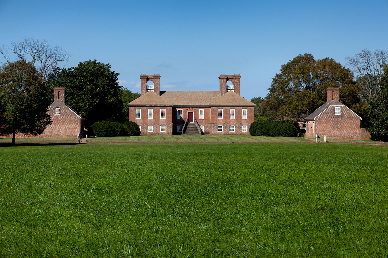
The grounds surrounding Stratford Hall Plantation are an environmentalist’s dream. Fully intact, the 1,900 acres have close proximity to Washington, D.C. Thomas Lee purchased nearly 1,500 acres in 1717. Here he built the Great House, a Georgian brick mansion that is both grandly and distinctly British, and installed his wife Hannah and their growing family, which swelled to eight children.
The union produced six sons, and five participated in Revolutionary history. The eldest, Philip Ludwell Lee, has been called a “passive loyalist.” But the remaining five were described by John Adams as the “band of brothers, intrepid and unchangeable…who stood in the gap in defense of their country.” Two, Francis Lightfoot Lee and Richard Henry Lee, went on to sign the Declaration of Independence (the only brothers who did.) Thomas Ludwell Lee became a judge and revolutionary. Arthur and William Lee were distinguished for their work as diplomats in Europe.
Another Lee descendant, Henry, or “Light Horse Harry,” became a Virginia governor. “He was not a son of Hannah and Thomas, but a major Revolutionary War hero. He was an important figure at Stratford. Also, he was buried in 1818 following a premature death on Cumberland Island in Georgia,” says Barrett. The details of Light Horse Harry’s sad end were noble, befitting a heroic figure—he died of injuries received while defending another’s rights. A ceremonial burial on Cumberland Island bespoke Lee’s high station. Lee purportedly was accorded a full military burial provided by an American fleet stationed near St. Mary’s, Ga. His remains were moved later to a Lee family crypt in Virginia.
Even so, “a tombstone still marks his formerly peaceful resting place in the Golden Isles of Georgia,” adds Barrett, who conducted research there last year.
Robert Edward Lee was the son of Henry Lee and his second wife, Anne Hill Carter. Robert E. Lee became best known of all Stratford Hall occupants. Robert E. Lee, the sad and reluctant Civil War general, is most associated with the place though his time there was briefest. He only lived there until the age of three and it was never his home again. He died in Lexington, Va., in 1870.
Stratford Hall languished for decades in the hands of an owner related to the Lees by marriage, and could easily have been lost. During the Great Depression, Stratford Hall was purchased and restored by a group of determined and well-connected women who formed an association for its preservation.
Today, it is still maintained by RELMA, the Robert E. Lee Memorial Association, and its numerous state delegates. Their presence is felt – it is borne on the cabins each state delegate uses while at Stratford Hall, and by the mere fact that they managed something so impossible. The women of RELMA spared beautiful and desirable lands from the developer’s bulldozer.
For historians, Stratford Hall is a dream as well, in that there are hundreds of acres of burial grounds, vaults, pastures, farmlands and mysterious footings, archaeological dig sites with present and future possibilities, and perfectly preserved buildings. All are remnants of a history imbued with folklore, culture, controversy and complexities.
For example: The cabin of William Wesley Payne was recreated at Stratford Hall (“There was a near-miss from hurricane Irene,” says Barrett.) Descendants of the Payne family, who lived longer at Stratford Hall than any members of the Lee family, gathered for their second reunion on June 25, 2011—their first was in 2001. This revealed another aspect of Stratford Hall.
“William Wesley Payne was born in 1875,” says Cosgrove, who photographed both Payne family reunions at Stratford Hall. Tim Barrett was also present at the 2011 reunion along with Cosgrove. They were privy to first-hand observations from the Payne family.
“The Payne family reunion included descendants of Uncle Wes Payne, whose (reconstructed) cabin stands on the property,” Cosgrove explains. He observed the grandson of William Wesley Payne being shown the cabin which depicts former servant quarters. The child misunderstood the rustic cabin’s historical context. “The little boy was saying, ‘This would be a cool place to camp.’”
Cosgrove was strongly affected by the Payne descendants’ “great sense of pride of their connection with Stratford.” Many family members are buried on the grounds.
“You could randomly have a conversation with them, and they all knew where they fit into the family tree. There was a sense of pride in being attached to Uncle Wes, and to Stratford. It was pride of place, that, ‘This place couldn’t have existed without us,’” says Cosgrove. Barrett’s research group is requesting permission to conduct oral histories of surviving Payne family members.